Florence Airport (FLR)
Orientation and Maps
(Florence, Italy)
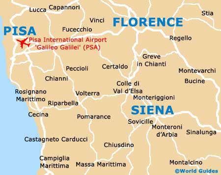
One of Italy's most famous cities, Florence (Firenze) is the capital of the Tuscany province. With a population exceeding 400,000 and many spectacular buildings, Florence is located around 105 km / 65 miles to the east of Pisa and its nearby coastline.
Amerigo Vespucci Airport (FLR) is located on the north-western outskirts of Florence and is well connected to the city by the A1 (Autostrada del Sole) and a number of other main roads. Pisa's Galileo Galiliei Airport is also nearby, being only 95 km / 60 miles from Florence and a popular alternative.
Florence Amerigo Vespucci Airport (FLR) Maps: Important City Districts
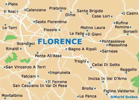
The city of Florence lies along the Arno River and the historic centre has gained the prestigious UNESCO title of World Heritage Site, due to its high concentration of historic buildings. Santa Maria Novella is the city's main train station and is often referred to as the 'Firenze SMN', being located to the north-west of the centre and along the Via Luigi Alamanni.
Dominating the city centre, Florence's world-famous Duomo cathedral (Santa Maria del Fiore) dates back to the 14th century and is the city's tallest structure. Many areas of interest are nearby and the Duomo is the perfect point of reference around which to judge distances and directions. The main tourist office in Florence is situated on the northern side of the Duomo and offers a range of maps and leaflets, which further offices at the Piazza della Stazione and the Borgo Santa Croce.
Italy Map

Florence Map